.jpg)

What is Decoding Spaces?
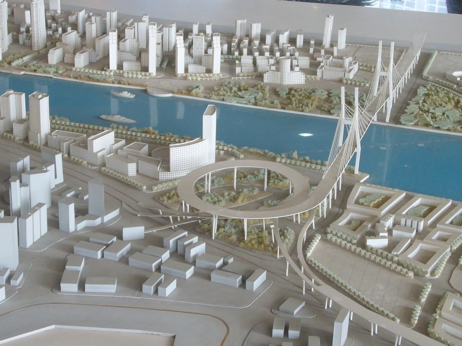
Decoding Spaces is an analytical approach that helps architects and planners understand the underlying patterns and structures of urban environments. It examines how spaces are organized, how they connect, and how people experience them, enabling professionals to move beyond surface-level observations of cities. By analyzing the interactions between buildings, streets, and public areas, it uncovers insights into urban dynamics. This approach is widely applied in urban analysis architecture to support more informed design decisions.
Key features of Decoding Spaces:
- Evaluates spatial hierarchies to identify which areas dominate the urban layout and which serve as secondary or supporting zones.
- Maps circulation patterns to clearly understand how pedestrians and vehicles move through different parts of a city.
- Assesses density distribution to analyze how population, buildings, and activities are concentrated across urban areas.
- Highlights visual and spatial continuity to track connections between areas and understand how people navigate and experience the environment.
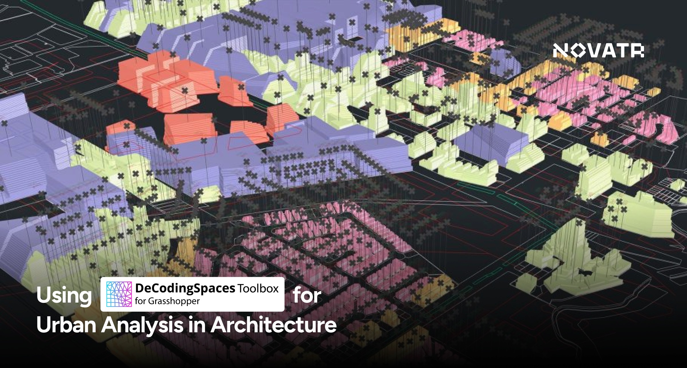
Applications of Decoding Spaces in Urban Analysis
.png?width=1059&height=896&name=Grasshopper_MainWindow%20(1).png)
Decoding Spaces offers diverse applications for understanding and shaping urban environments. By analyzing city structures, architects and planners can uncover hidden spatial patterns, optimize layouts, and inform data-driven decisions across mobility, land use, and social interactions.
1. Optimizing Pedestrian and Traffic Flow:
Analyzes movement to locate congestion points and improve circulation for safer pedestrian and vehicular flow.
For Example: In Times Square, New York, spatial analysis improved pedestrian circulation and street accessibility.
2. Enhancing Public Space Usage:
Studies interactions in streets, plazas, and parks to boost engagement, comfort, and accessibility.
For Example: In Barcelona, the superblocks project redesigned streets and plazas to enhance social interaction.
3. Supporting Land Use Planning:
Identifies functional zones and spatial relationships to guide residential, commercial, and recreational area allocation.
For Example: In Marina Bay, Singapore, analysis guided mixed-use development and strengthened urban cohesion.
4. Informing Urban Density and Housing Strategy:
Examines population and building concentration to propose efficient housing layouts and maintain community networks.
For example: In Dharavi, Mumbai, density analysis informed sustainable housing solutions while preserving social structure.
5. Guiding Infrastructure and Transportation Design:
Maps connectivity to plan infrastructure and transport routes aligned with sustainable urban growth strategies.
For example: In Curitiba, Brazil, analysis-guided bus rapid transit planning aligned with a model of urban development focused on efficiency and sustainability.
6. Evaluating Mixed-Use Development Potential:
Assesses spatial relationships to identify areas suitable for residential, commercial, and recreational integration, supporting balanced urban growth.
Real-life Example: In Portland, Oregon, spatial analysis guided optimal sites for mixed-use developments, improving walkability and local economic activity.
Decoding Spaces - Step-by-Step Use in Grasshopper

Using Decoding Spaces in Grasshopper helps architects and urban planners turn spatial analysis into computational models, exploring patterns, connectivity, and density to generate actionable insights for design and planning.
Here is a step-by-step workflow to apply this method efficiently:
Step 1. Define the Study Area
Select the urban site and import GIS, CAD, or map data into Grasshopper to establish spatial boundaries and key elements like streets, buildings, and public spaces.
Step 2. Import and Prepare Data
Organize layers logically, clean errors, and categorize elements by function to ensure accurate and smooth computational analysis.
Step 3. Establish Spatial Parameters
Set distances, connectivity, adjacency, and density parameters to guide evaluation of spatial hierarchies, circulation, and visual continuity.
Step 4. Create Analytical Models
Use Grasshopper components to build grids, graphs, or diagrams that simulate movement, accessibility, and spatial relationships across the study area, demonstrating effective Grasshopper urban analysis.
Step 5. Visualize Patterns and Relationships
Generate heatmaps, color-coded diagrams, or 3D models to identify dominant zones, circulation bottlenecks, and spatial opportunities clearly.
Step 6. Interpret Results for Design
Analyze outputs to detect inefficiencies and identify improvements that can inform urban planning, street design, and public space enhancements.
Step 7. Refine and Iterate
Adjust parameters and assumptions to test multiple scenarios, ensuring results are adaptable and conclusions remain robust for planning decisions.
Step 8. Integrate Findings into Planning
Export visualizations and data to incorporate insights into architectural proposals, zoning strategies, or urban development plans for evidence-based design.
Tips for Architects & Urban Designers
Here are some practical tips for effectively using Decoding Spaces in architectural and urban analysis workflows:
- Always start with clean and accurate spatial data to ensure reliable analytical results and prevent distortions in mapping or visualization.
- Define clear project objectives before setting parameters so that the analysis aligns with specific planning or design goals.
- Use the decoding spaces plugin in Grasshopper with organized data layers to streamline computation and maintain clarity during complex modeling.
- Visualize outcomes using clear diagrams or heatmaps to communicate findings effectively with clients and stakeholders.
Where to Learn Decoding Spaces?
Learning Decoding Spaces effectively requires structured guidance in computational design tools and workflows. The Master Computational Design Course by Novatr offers practical, mentor-led training to help architects and planners apply data-driven techniques confidently in real-world urban projects.

With Our Computational Design Course, you'll:
- Learn 5 powerful industry tools — Grasshopper, Rhino 3D, Flux.ai, ComfyUI, and D5 Render.
- Master popular plugins like Paneling Tools, DeCoding Spaces, Anemone, Galapagos, Wallacei, LunchBox, Open nest and Horster Animation to create smarter, faster design workflows.
- Understand how to build parametric and generative design workflows used by top global firms.
- Learn how to automate repetitive design tasks, explore AI-driven creativity, and produce high-quality renders for presentations.
- Develop a professional computational design portfolio showcasing your project-based learning.
Earn dual certification from Novatr and NSDC (National Skill Development Corporation) upon completion, and step confidently into the world of future-ready architecture and design.
Disclaimer - Course details, including curriculum, duration, fees, and related information, are for informational purposes only and may change at the company’s discretion without prior notice. Please visit the official course page or contact our admissions team for the latest updates.
.png)