.jpg)

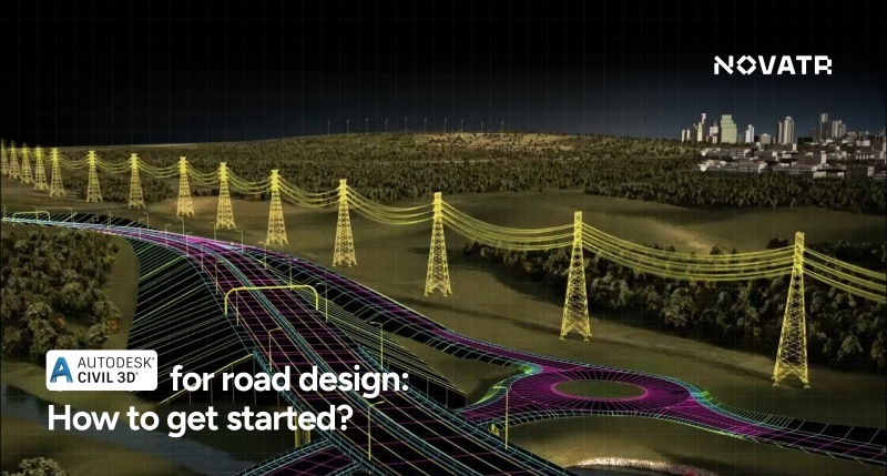
Why Highway Alignment Design Still Matters in 2026

In 2026, highway design with BIM learning is more important than ever. As traffic needs have increased, concern for the environment has become relevant, and one aspect that has become of much consideration is the precise way the highways are made. Road alignment in Civil 3D will not just make sure that highways are safe and functional, but its construction does not cost the environment a fortune.
With tools developed to combine geometric design and 3D models, Civil 3D has enabled engineers to make intelligent decisions and optimize the design process. The 3D modelling in Civil 3D also enables simulations to analyze environmental issues, resulting in more environmentally conscious design. Learn BIM and highway design to maximize learning how to use such a powerful tool to design contemporary road infrastructure..
Creating Existing Ground Surfaces

The initial point in designing highways is to establish the pre-existing level ground, which will become your design's base. The simplified version will be through Civil 3D, where you can directly import survey data or DEM files and incorporate them into the model. By clicking the Insert tab, you can directly import the point cloud or surface data. This would be an essential step to producing realistic terrain and forming the foundation of your geometric design of a highway using AutoCAD Civil 3D.
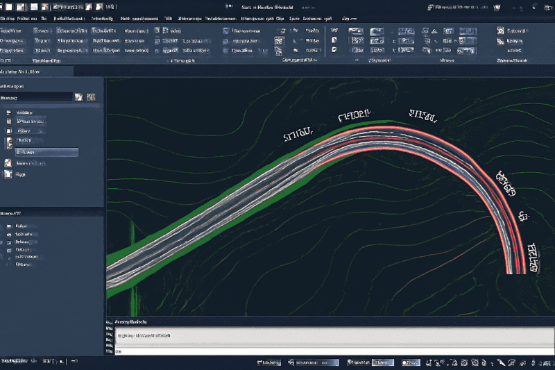
Drawing Centerline Alignments & Design Profiles

The next step is drawing the centerline alignment, which defines the path of the highway.
- Horizontal and Vertical Curves: These curved lines are essential in constructing roads by promoting safety; hence, in civil 3D, it is possible to design both horizontal and vertical curves. Curves are fundamental in facilitating easy speeds and easy shifts of road sections.
- Best Practices: When designing highways with Civil 3D, it is advisable to reduce sharp curves and steep slopes. Take advantage of the design checks facility to ensure the curves and grades are safe for vehicles. Factors of environmental arrangement, traffic density, and the shape of roads must be addressed during the design process.
Cross-Sections and Corridor Modeling

After you put the alignment in, you have to specify the cross-section of the road and develop the entire corridor model.
- Design Templates: Civil 3D contains pre-defined design templates to make quick work of road cross-sections. Such templates establish the width of a lane and a shoulder and other road characteristics. It is also possible to develop individual templates of specialized road designs.
- Assembly Insertions: Once you have chosen a template, you can insert assemblies over your alignment. The infrastructure may entail different features, including lanes, sidewalks, and drainage systems. The workflow for Civil 3D road alignment allows for establishing uniformity in design work across the project team.
Setting Superelevation, Widening, and Road Parameters
Widening and super elevation are important aspects in the design of highways, particularly curves and high traffic zones.
- Superelevation: Superelevation is also automatically computed in Civil 3D through curve radius and design speed and assists you in handling centrifugal forces in a controlled manner. This provides smoother and safer curves on high-speed highways.
- Widening: During the design of a highway in Civil 3D, you may want to widen some of the areas so that they can accommodate intersections or merging lanes. It is in Civil 3D that you can control the widening at the appropriate places with smooth transitions between regular and widened roadway areas.
- Road Parameters: Adjust lane widths, shoulder slopes, and drainage systems to suit your design requirements. The versatility of Civil 3D will allow you to adjust these variables as design changes.
Volume Calculations and Section Sheets
Volume calculations for earthworks are an essential part of the design process.
- Automating Cut-Fill Reports: To create cut-fill reports automatically, compare your design surface with the existing ground surface, and generate a report that tells you how much material transfers (or cuts and fills) in the civil 3D. The reports determine the quantification/cost of material used in construction.
- Section Sheets: You can create section sheets detailing the design at different points along the highway to document the design. Such sheets give accurate details of the geometrical study of the road, which is the vital information construction groups require.
Exporting Design to InfraWorks / Revit for Coordination
When your design has been completed, coordinate with other disciplines and view the highway in 3D. You can export your design to such tools as InfraWorks and Revit with the help of Civil 3D to develop something like a detailed 3D model of the highway and its surroundings. This integration makes them more collaborative, visualisation and analysis processes, facilitating the construction process, as issues that may arise can be known before the construction.
How To Learn Civil 3D For Highway Design?

To master highway design using BIM, learning Civil 3D is crucial. Whether you're a beginner or aiming to enhance your skills, structured courses can help you build proficiency. Our Building Information Modelling (BIM) course in Civil Engineering covers everything from Civil 3D fundamentals to advanced model-based coordination across multiple disciplines, including alignment design.
This Civil 3D online course offers hands-on training in alignment and profile design in Civil 3D, including simple methods and complex procedures in highway design. After pursuing this course, you will become competent in designing highways effectively and precisely.