What are the latest trends in Landscape Architecture Visualization?

Have you ever stared at a flat construction map and struggled to imagine what a new park would actually feel like? You aren't alone. Today's landscape architecture visualization trends are tossing those confusing blueprints aside for something resembling a high-end video game.

Instead of sketching static lines, modern designers sculpt with "digital clay." This 3d landscape visualization allows them to mold terrain on a screen, creating a virtual world you can explore from any angle. In practice, this immersive shift prevents costly design errors before construction even begins.

We've all seen a plaza built that completely clashes with its surroundings. Interactive technology solves this visual uncertainty, guaranteeing that communities and creators share the exact same vision.

BIM Professional Course for Architects V2.0

Learn Revit and 15+ BIM software with industry workflows in just 7 months.

Apply now

*Limited seats available

Watch the Seasons Change in Seconds: The Power of Real-Time Rendering

Waiting hours for a computer to process a single, static image of a future backyard is a thing of the past. Today's designers use technology that acts like a "Live Filter" on your smartphone camera, instantly updating the scenery as they tweak it.

Instead of staring at a loading screen, architects use real-time rendering software for landscape design to instantly shift the sun's angle or swap out dying plants. While professionals debate tools like Twinmotion vs Lumion for outdoor environments, the real benefit is yours. You can watch shadows stretch across a patio in seconds, ensuring your new seating area stays comfortable and shaded.

Because designers can simulate weather instantly, they remove all the guesswork from neighborhood planning. You can immediately evaluate how a public square feels during a summer downpour or a snowy winter evening, guaranteeing that local trees and pathways thrive in their exact locations.

This ability to edit on the fly gives everyone absolute clarity about how a space will age and evolve. Once this living digital world is built, stakeholders can step directly inside these environments.

change of season with rendering

Step Inside a Park That Doesn't Exist Yet: Immersive Virtual Reality

Imagine putting on a headset and suddenly standing inside the exact garden you just viewed on a monitor. This complete sensory takeover is Virtual Reality (VR). Designers now use immersive virtual reality walkthroughs for clients to let you feel the true, human scale of an environment before construction begins.

Alternatively, your smartphone can act as a magic window into the future. Using augmented reality for on-site design visualization, you can stand in your empty backyard and see digital features perfectly overlaid onto the physical grass. Both of these technologies prevent costly construction mistakes by helping you instantly evaluate three common design misunderstandings:

  • If walkways are actually wide enough for two people to stroll comfortably.

  • Whether the mature height of new digital trees will eventually block your favorite view.

  • If a solid privacy fence makes the proposed seating area feel too claustrophobic.

Exploring these lifelike spaces builds absolute confidence in your layout choices, ensuring the surrounding environment actually thrives and scales properly alongside new elements.

How AI Shapes Smarter Landscapes

Starting a project is intimidating, but technology transforms how we brainstorm. Instead of staring at blank maps, designers use generative AI tools for site conceptualization. Think of it as a digital assistant instantly sketching dozens of unique park layouts.

This intelligent collaboration leads to more creative site options. Rather than drawing three ideas manually, designers review fifty variations in an afternoon, finding the perfect layout for your neighborhood.

Adding nature comes next, which is no longer a tedious chore. Software now utilizes procedural vegetation modeling for large scale sites. Instead of placing every fern manually, you simply click once to grow an entire digital forest following natural biological rules.

Instantly, environments fill with stunning, photorealistic plant assets for 3D modeling. Because AI builds these lifelike spaces effortlessly, designers can immediately test how they survive future weather patterns through environmental simulation.

The 'Virtual Shadow': Using Digital Twins for Greener Cities

What if you could see your garden twenty years from now, in just seconds? Designers achieve this by building a "Virtual Shadow" before moving any dirt. This starts by understanding how to integrate BIM in landscape projects Building Information Modeling, which creates data-rich 3D blueprints. These blueprints become digital twin technology for smart urban landscapes, living computer models mirroring real spaces.

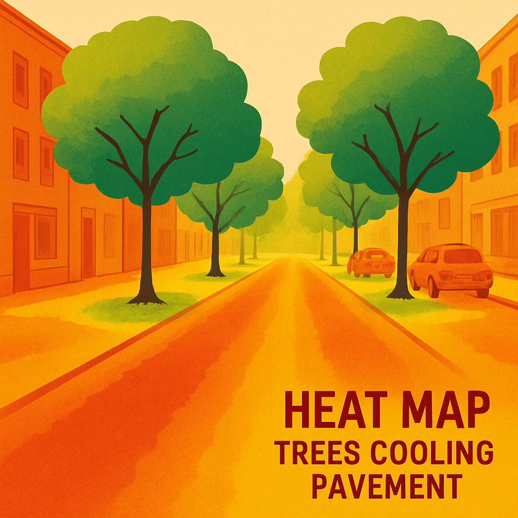
Guessing if a new neighborhood will flood is risky, so planners rely on sustainable design analysis through environmental simulation. By feeding local weather data into this virtual shadow, a digital twin instantly simulates:

  • Water runoff: Tracking rain paths to prevent flooded patios.

  • Heat island effect: Showing where new trees will naturally cool hot pavements.

  • 20-year tree growth: Revealing exactly how today's sapling will shade your yard decades from now.

Testing nature digitally guarantees greener, highly resilient communities. Yet, before these intelligent models work, they need a flawless physical foundation backed by exact real-world dimensions.

heat mep for the tree pavement

Why Drones and 3D Printing Matter

Measuring a steep, rocky backyard with a simple tape measure is notoriously difficult and inaccurate. Today, designers fly drones overhead instead, utilizing drone photogrammetry for accurate site surveying essentially taking hundreds of aerial photos to instantly build a perfect 3D scan. This captures every hill in minutes, saving weeks of difficult physical groundwork.

Once scanned, computers shape the new landscape using parametric design for complex terrain modeling. Think of this technology like "digital clay" that automatically adjusts pathways to safely fit steep natural slopes. To help everyone truly grasp these outdoor changes, design teams then utilize 3D printing for physical site prototypes.

Holding a miniature, true-to-life version of a future park lets you physically trace new walkways with your finger. This hands-on clarity builds absolute confidence before construction begins.

Learn Revit and 15+ BIM software with industry workflows in just 7 months.

Apply now

Conclusion

You no longer have to squint at confusing blueprints. The shift from guessing to knowing brings ultimate clarity to any project. By reducing 3D rendering time with cloud computing, designers can adjust virtual environments instantly. These interactive landscape design presentations for stakeholders ensure you finally have a clear voice in shaping your community.

Visualization is about making smarter choices, not just pretty pictures. Experiencing a space early leads to better public parks and beautiful backyards. The next time you plan a project, empower yourself. Simply ask your designer, "Can I walk through this in 3D?"

FAQs

1. What makes real-time rendering a game-changer for landscape projects?

It turns static visuals into living, adjustable scenes you can evaluate instantly. Designers can shift the sun’s angle, test different plants, and simulate weather in real time so you watch shadows move across a patio or see how a square feels in a summer storm or snowy evening. This immediacy removes guesswork, exposes issues early, and helps everyone agree on how a space will function through the seasons.

2. How do VR and AR differ in landscape visualization, and what problems do they solve?

VR puts you inside a fully virtual, human-scale version of the design via a headset, while AR uses your phone to overlay proposed features onto the real site. Together, they prevent common misunderstandings confirming walkways are wide enough for two people, checking if mature trees will block key views, and revealing whether a solid fence makes a seating area feel too confined before construction begins.

3. How is AI used to create smarter, more realistic landscapes?

AI jumpstarts concepting and realism at scale. Generative tools produce dozens of layout options in hours, while procedural vegetation “grows” entire plant communities that follow natural rules. With photorealistic plant assets and environmental simulation, designers can rapidly populate scenes and test how layouts and species perform under future weather conditions.

4. What are BIM and digital twins, and how do they support sustainability?

BIM creates data-rich 3D blueprints that evolve into digital twins live models mirroring real places. By feeding local weather data into these twins, teams simulate water runoff, heat island effects, and 20-year tree growth. The results guide decisions that reduce flooding, cool hot surfaces with strategic tree placement, and plan for long-term shade and resilience.

5. Why do drones, photogrammetry, parametric modeling, and 3D printing matter?

They ground visuals in accurate site data and make designs tangible. Drones and photogrammetry capture precise terrain quickly, parametric modeling adapts paths and forms to complex slopes, and 3D printing turns proposals into physical models you can hold and review. Combined with cloud-enabled, interactive presentations, these tools align stakeholders and build confidence so you can literally “walk through it in 3D” before a shovel hits the ground.

Was this content helpful to you

Dislike No

TABLE OF CONTENTS

Download Syllabus
BIM Professional Course for Civil Engineers

course benefits

40+ live & bonus sessions

1 RIBA-structured capstone project

Learn 8+ BIM software

Autodesk & NSDC certifications

6 guided career sessions

Lifelong access to course content & community

Career counselling & interview preparation

Enter your details to download the course syllabus.

Download Syllabus
BIM Professional Course for Architects V2.0

course benefits

70+ live sessions

3+ RIBA and ISO 19650 structured capstone projects

18+ BIM software access

10+ guided career sessions

Certificates from Autodesk and NSDC

Lifelong access to course content & community

Career counselling & interview preparation

Enter your details to download the course syllabus.

Download Syllabus
Master Computational Design Course for Real-World Application

course benefits

80+ live sessions

50+ assignments

5+ softwares, 15+ plugins

Career counselling and interview prep

Lifelong access to to course content & community

Enter your details to download the course syllabus.

Download Syllabus
Advanced Interior Design with AI

course benefits

Simulated project based learning

Career counselling and interview prep

Lifelong access to course content

Learn 8+ software

3 Certificates of Achievement

Enter your details to download the course syllabus.

Download Syllabus
BIM Professional course for MEP Engineers

course benefits

Autodesk and NSDC Professional Certificates

12+ BIM softwares and plug-ins

80+ hours of live classes

Create 10+ toolkits to kickstart your MEP BIM project.

Dedicated Program Manager and Industry Guide Support

1:1 Career Mentoring

Networking with AEC Industry Professionals

Top 10% learners get exclusive Innovation bootcamp access.

ISO 19650 for BIM workflows

Enter your details to download the course syllabus.

Ready to skyrocket your career?

Begin your next chapter in AEC

with Novatr!

We are here to help you take the industry by storm with advanced, tech-first skills.