


Why Is the Zoji-la Tunnel a Major Construction Challenge?
Here's the reality: the Zoji-la Tunnel is not your typical highway infrastructure project. The terrain is geologically complex, temperatures can fall to -18°C, and avalanche threats remain constant throughout the winter months. The challenges pile up: complex geology, water seeping into rock, and relentless extreme cold.
Because of these factors, there must be strict safety protocols for construction so that the thousands of workers can perform their jobs. Digital construction planning is no longer optional. Projects of this complexity require BIM-enabled workflows and collaborative coordination processes. This is where real-time monitoring integrated with BIM systems helps keep teams productive and safe and advances the tunnel construction process.
How Is BIM Supporting Zoji-la Tunnel Construction in Harsh Terrain?

Megha Engineering & Infrastructures Ltd (MEIL) is implementing the New Austrian Tunnelling Method (NATM) technology in line with European standards, a method particularly suited to fragile Himalayan geology and variable rock conditions.
Digital construction through BIM infrastructure complements this approach. Advanced technologies, including BIM, Geographic Information Systems (GIS), and the Internet of Things (IoT), identify critical nodes and breakthroughs. Supported by detailed BIM models and multi-level digital management platforms, projects can then effectively address construction challenges in tunnels and complex structures.
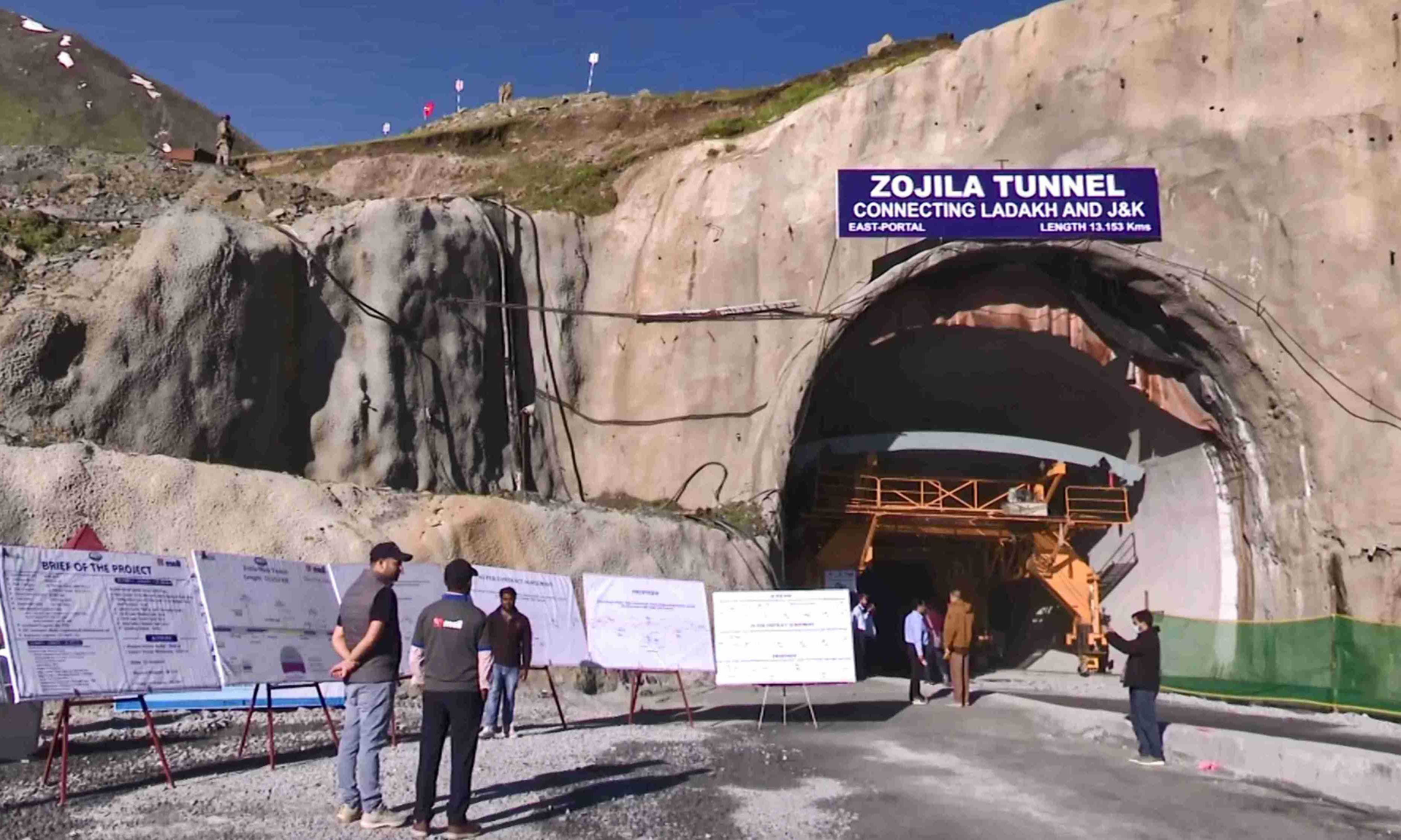
For the Zoji-la Tunnel, the BIM workflow serves critical functions. BIM coordination helps teams track excavation progress from both ends of the tunnel simultaneously. Construction safety is also enhanced when teams can visualise real-time site conditions through digital engineering tools, making project coordination easier when more than 1,200 workers can access synchronised project models showing equipment placement, ventilation routes, and emergency procedures.
BIM technology has five key characteristics: visualisation, coordination, simulation, optimisation, and automated drawing, all essential for managing tunnel construction in this extreme transportation infrastructure environment. This is how BIM is supporting the Zoji-la Tunnel construction in harsh terrain.
What Problems Can BIM Solve in High-Altitude Infrastructure Projects?
High-altitude tunnel construction presents unique challenges, where small issues can quickly escalate into major operational problems, leading to communication breaking down. Geological changes come up unexpectedly, and safety risks multiply.
Mountain tunnel construction involves constantly evolving geological and safety risks. BIM-based digital platforms combine monitoring and measurement with advanced geological prediction, enabling dynamic management that becomes increasingly essential.
BIM coordination systems improve communication across project teams by using models to access different levels of management work according to different user roles. This matters for the Zoji-la Tunnel, where teams are distributed across harsh terrain. BIM technology enables automatic safety risk identification, builds integrated knowledge bases for risk management, and analyses complex risk factors, extracting and analysing large amounts of engineering data for information integration and sharing.
For infrastructure projects in extreme environments, BIM infrastructure transforms how teams handle construction safety and project coordination with predictable workflows. These are a few of the many problems that BIM can solve in high-altitude infrastructure projects.
How Do BIM and Digital Tools Improve Safety and Coordination?

BIM-based platforms combine monitoring and measurement with advanced geological prediction, realising the informatisation and visualisation of risk management in tunnel construction. For the Zoji-la Tunnel, where avalanches are a threat and temperatures plummet, this means teams can predict hazards before they occur.
BIM allows different team members to access the information they need based on their roles, making project coordination more organised. Site managers, safety officers, and excavation teams all work from the same digital construction model, eliminating the errors that can be life-threatening.
Real-time data through smart infrastructure sensors transforms safety management. When these sensors feed into BIM workflow systems, the dynamic changes. Rock instability is detected, and teams are alerted instantly rather than discovering problems during shift changes. Equipment placement updates propagate to all stakeholders immediately. Project coordination shifts from reactive problem-solving to proactive, data-driven decision-making. This integration of monitoring technology with digital construction platforms is what makes BIM infrastructure essential for extreme environments like the Zoji-la Tunnel.
What Can India’s Infrastructure Sector Learn From the Zoji-la Project?
The Zoji-la Tunnel serves as a valuable case study in delivering complex infrastructure projects under extreme conditions.
Firstly, scale demands digital construction. India has dozens of ambitious highway infrastructure projects in extreme terrain. Repeating the mistakes of older projects, communication gaps, safety incidents, and timeline slippage is wasteful. The Zoji-la project shows that BIM infrastructure and digital engineering are not optional; they are necessities for engineering projects at this level of complexity.
Second, construction safety requires real-time visibility. Traditional site inspections cannot catch hazards in this particular terrain. The Zoji-la project demonstrates that smart infrastructure systems monitoring geological stability, weather patterns, and worker locations save lives and prevent disasters.
TABLE OF CONTENTS
